Newcomer with a project

Blake_Flynn

New Member
Good day to you all,

I am new this community and looking for advice on the feasibility for a project. I would like to use a quadcopter to accurately measure wind speed and direction at various altitudes. This post is the beginning of my journey and I'd like suggestions on how to achieve this, best hardware for the purpose and generally some suggestions on developing this capability.
Thank you in advance for any guidance you can provide.
 
Basically any quad that has "sufficient power" to fight whatever wind speeds it's encountering to attempt to hold position and has a GPS module with ability to hold position fairly well would work. Main concerns here for me would be where to do the testing such that if the quad begins to drift from some high altitude it doesn't end up over someones private property or person/things. Second concern would be can only legally go up to 400ft in US at least, is actually probably higher than would think and is higher than I'm comfortable flying personally but depending on what altitudes you want to survey (or location) this may be a non-issue.
 
Basically any quad that has "sufficient power" to fight whatever wind speeds it's encountering to attempt to hold position and has a GPS module with ability to hold position fairly well would work. Main concerns here for me would be where to do the testing such that if the quad begins to drift from some high altitude it doesn't end up over someones private property or person/things. Second concern would be can only legally go up to 400ft in US at least, is actually probably higher than would think and is higher than I'm comfortable flying personally but depending on what altitudes you want to survey (or location) this may be a non-issue.
Thank you for the feedback Wafflejock. Ultimately I'd like to measure winds up to about 30mph which from my limited understanding will require a fairly heavy duty quad. I'm familiar with civil aviation regulations for Australia and will be testing the capabilities in a regional area where I have permission to access large private landholdings for this purpose.
I'm interested in how the data can be accessed from the drone. For example if the drone is hovering stationary at 200ft AGL compensating for a 12mph wind coming from 180* mag how can I retrieve that data?
 
Okay sounds reasonable :)

Basically two pretty good ways to get data that I know of. The first option is using some sort of data logger on board the quad, using iNav or betaflight or pixhawk or ardupilot there are various flight control boards that have built in flash memory (accessed via USB and the flight controller configuration program) or can have a microsd card added in that can pull out to get data off of. Downside there is depends on the flight control board/software being used (or doing something custom with raspberry pi zero or something similar), also need to then parse the data log file to find the relevant info to extract. Second option still involves logging and some parsing but can basically send sensor data back via telemetry which means basically to your controller and have it log the telemetry data, the telemetry data for expresslrs I know includes GPS info but not sure how you would go about feeding extra sensor data into there (from air speed indicator).

In betaflight "world" of firmware/FCs the term for the logger is the betaflight black box logger and there is a separate app called the betaflight black box log viewer for opening and playing back the files (to overlay on video for stick input and to help diagnose issues with tuning out vibrations or wobbles)
 
Interesting project, but I can foresee some problems to overcome.

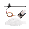
The quad itself creates considerable disturbance to the air around it. This airflow will affect any sensors, so your anemometer probe would need to be on an extended arm, clear of propeller wash. A simple method could use a small propellor on a tiny electric motor to produce a voltage proportional to the windspeed, mounted on the forward end of a pivoted arm with a flap on the other end, like a conventional wind vane.

If an arm orientation sensor then measures wind direction, a magnetic sensor might be affected by magnetic fields generated by the drone motors.


There are various instruments that can be used:

Alternatively, if the drone tilt angle and direction and motor power levels could be measured and recorded when in a stationary hover pointing north, that might be interpreted for your purposes, though this might require some mathematics and programming skills.

You may find it simpler to mount your instruments on a kite.
 
Back
Top